
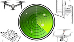
On-site at DJI's Los Angeles Zenmuse X7 media event, DJI also previewed a new software solution it's working on in order to help plan drone shoots during the pre-production stages. Currently under development, Project Vertex will allow users to build three-dimensional models of a location and to bring them back to the office for more accurate shot-planning.
Not only can you use the 3D scan for planning off-site, but you can also use it to place way-points in three-dimensional space that can then be translated back to the drone as an actual flight plan. A virtual flyover will allow cinematographers and directors to more accurately plan shots while the drone will capture the exact real-life shot based on the flight plan formed using Vertex when back on location for the actual shoot.
Project Vertex is still in its early stages, but the preview already showed a lot of promise. While we are hoping to see something ready to launch sometime next year, it's certain that whenever it does launch, it has the potential to save quite a bit of time scrambling around on location.


So they’ve added photogrammetry
It definitely is a little more involved and covers more than just photogrammetry, but yes, that's certainly part of the new software ;-)