
Whether you’re looking to plan a perfect landscape shot to coincide with an astronomical event or just want to previsualize some potential viewpoints before a trip, there are a number of free or inexpensive apps that can help you create your best images.
While I’ve used these apps for planning landscape and travel shots, they can be applicable to almost any style of photography that takes place outdoors. Portrait sessions can be planned out to maximize light, scout potential locations, and track your favorite spots. Astrophotographers can plan around foreground elements. Essentially, if you’re shooting outside a studio, these apps can help you make the best use of light and location.
PhotoPills
PhotoPills is basically a must download. While it isn’t free, like some of the other options on this list, it sets itself apart by offering more features and emphasizing usability. While 90% of my use is for its astro-planning features, including sun, moon, and Milky Way planning tools, it also offers a number of useful utilities. These include field of view, time-lapse, and depth of field calculators, meteor shower planners, and an equivalent exposure calculator.
The reason why 90% of my time is spent in the astro-planning features is because it does planning better than any other app on this list. The augmented reality feature is really a game-changer compared to any other map-based tool (it offers the map view as well). By letting you look through your phone’s camera, you can actually see the path of the astronomical objects across the sky, making it easy to fine-tune alignment. No more guessing what that azimuth and altitude will actually translate into since you can just see them.
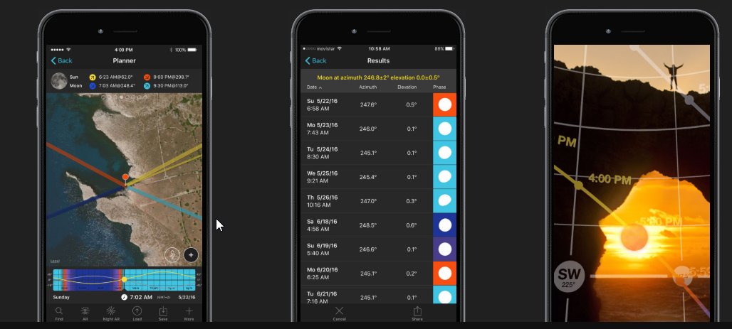
The only two downsides are the clunky interface for setting the time and the expense of the app itself. Since so much of the app revolves around moving forward and backward in time, the ability to set, recall, and change the visualized time needs to be perfect. Instead, it’s just good. Sweeping through times or jumping back to a certain point are clunky. Also, I’d love to see some form of calendar integration; once you’ve found a useful date, it would be great to just drop a geo-tagged calendar event into your Google Calendar. As for the expense, $10 for Android or iOS isn’t the end of the world, and I appreciate the non-subscription-based pricing. The downside to this is that with a little effort, you can duplicate the core functionality (excluding AR) with a few free tools.
The app is available for download from both major app stores for $10.
Google Earth
Google Earth, on the desktop, combines 3D buildings, travel planning, and accessible satellite imagery into one convenient tool. Smaller features like the ability to model sunlight across the landscape and create lists of potential locations further extend the usefulness of this as a planning tool. Being able to drop the angle of the camera and sweep around the landscape make it easy to identify a number of potentially useful locations. 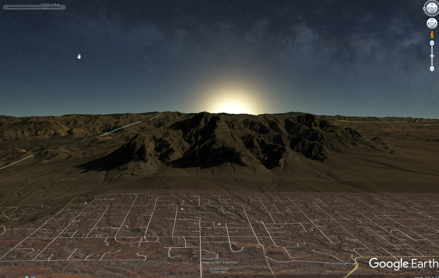
Adding “layers,” Google’s term for info like 3D buildings, places, and borders is what really makes this more useful than Google Maps alone. Interestingly, one layer includes Google Maps photos, making it even easier to get an idea of what it looks like on a ground level. Lastly, it offers tight integration with Street View, making it even useful for planning a shoot in a more urban environment, in contrast to a number of these other app options.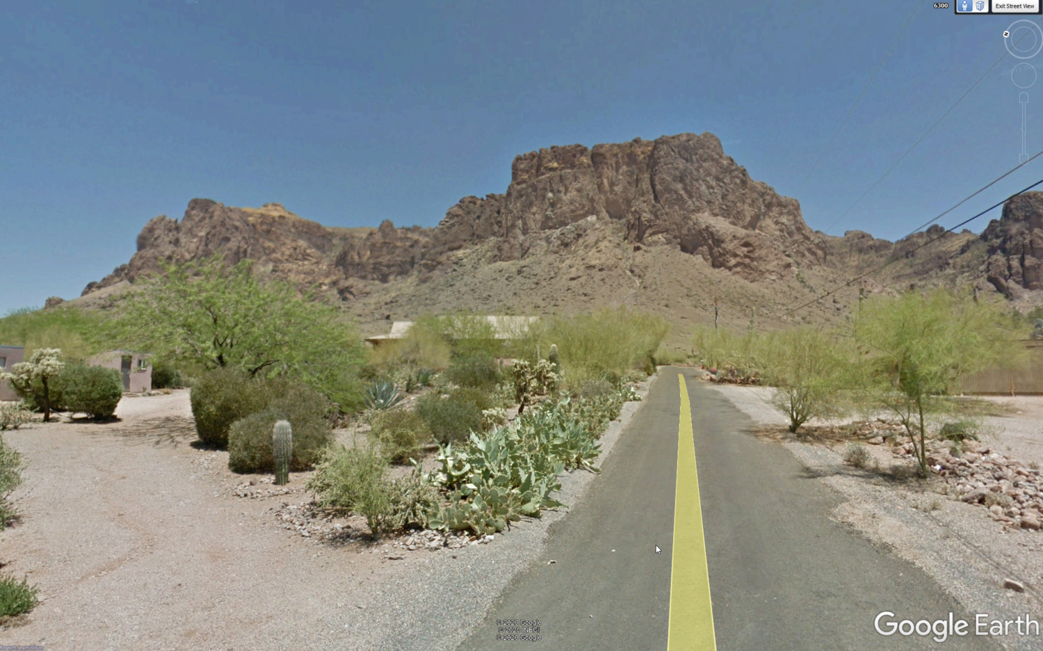
Google Earth Pro is available for download here.
Google Maps
Google Maps has obvious utility as a turn-by-turn navigation app. It’s also the best navigation discovery tool. What I mean by that is if you’re looking for an obscure trailhead, Maps can often find it just via search, even if it doesn’t seem like it’s marked on the map.
One tool that Google hasn’t heavily publicized, however, is the ability to create lists. Whether on the desktop or mobile app, you can add places to a list via “Your Places.” These lists can then be turned on or off, with the added points of interest showing up with prominence directly on the map.

A map of custom points of interest from the North Shore of Oahu.
I find this really helpful when exploring a new city, since I can throw restaurants, museums, photo spots, and more relevant locations onto the map.With that view turned on, it’s easy to see that I’m just a few blocks from a restaurant I was interested in and just a short walk from a great viewpoint, turning Maps into a personalized, location-aware guidebook. Conveniently, you can share and modify these lists, making group planning easier too.
With the most recent update, saved locations lists are now given more prominence in the bottom middle of the screen. It’s important to note the distinction between lists and “My Maps.” My Maps is essentially an amped-up version of lists, with support for custom icons and more layers (for example, photo spots and restaurants as different sets of icons). My Maps has worse functionality on mobile but a richer feature set. Both are accessed via mobile in the same way, so I’d suggest trying Lists first and going to My Maps if you’re looking for more control.
Google Maps is free to download from the App Store.
Photographer’s Ephemeris
If you just want to get started with planning around the sun and moon, but don’t want to commit $10 to an app, The Photographer’s Ephemeris is the web app for you. The web app is free to use. It provides a visualization of the sun’s travel, moon’s travel, and important times, as well as a visualization of their paths over a terrain map provided by Google Maps.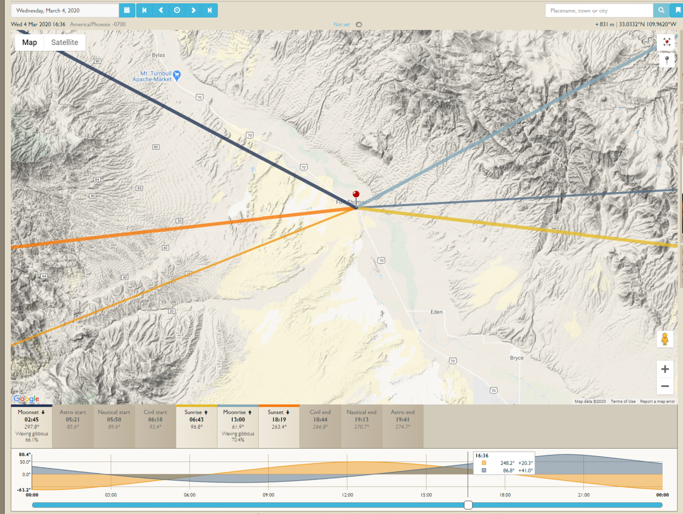
While the “lines on a map” interface is less user friendly than the augmented reality offered by PhotoPills, it’s perfectly serviceable for general planning. Frankly, I like the date and location interfaces better than PhotoPills. It’s as easy as clicking and dragging a pushpin to change the location, while the date can easily be adjusted.
The Photographer's Ephemeris is available online. If you find it useful, check out their paid mobile app offerings or consider making a donation.


I would argue stellarium is a great app for night planning along with google sky map. Both are easy to use even out in the field. I planned this shot using Stellarium.
Great shot! I've played around with Stellarium, but as my astro work has only been wide-angle shots, the AR in Photopills has been sufficient. I could definitely see the value if you do deeper sky shots.
I use both PlanIt and Photopills, the PlanIt has more features, the PhotoPills is a bit easier to pick up.
That's a good characterization of the two apps. I like some of Planit's features, but it can feel like a bit much for some shots.
"Sonnenverlauf" (german, english: course of the sun) is a free Android app. I do not know if it has an english user interface or if it is available for iPhones. It is straight forward and easy to use.
Interesting. Sounds like from the name that Photographer's Ephemeris would be the most similar.
I would add LunaSolCal Mobile. It has a similar mapping feature to PE.
Interesting, I've got to look at that one.
PhotoPills already has calendar integration. From the Planner mode, click on the 'More' button on the bottom right (three dots), choose 'Action', then 'Add to Calendar'. :)
Good to know Tom! That feels like a great example of how iOS makes passing info between apps awkward.
I'm on Android but I imagine it's similar on iOS too. PhotoPills is an amazing app and has truly levelled up my photography, but some of its finer details are a bit of a lottery to find. I've discovered a few of its features simply by accidentally holding my finger down too long, or tapping on something that I wasn't aware also functioned as a button.
Downloading these now! Thanks for the great suggestions!
Glad to hear they helped! Let me know what you think of them.
Has anybody tried, and have a recommendation or a don`t bother for any of the light metering apps?
My iPod is already too old (?) to get the latest apps. Using a cellphone (which I don't have) is useless to me because where I shoot my photos there is generally no reception...!
I prefer to look and take my time - no apps, no stress.