I have to admit that this isn't something I had envisioned doing with a drone, but boy, is it neat. DroneDeploy allows you to autonomously create 3D models of buildings and terrain as well as 2D analyses, and the best part is that it's free.
Creating 3D models of terrain and structures is a tremendously useful skill, and it's also just really cool. DroneDeploy is a combination of an autopilot app and a cloud computing platform that works with all recent models of DJI drones and allows you to easily generate three-dimensional models of terrain and structures, elevation and crop health analyses, and even orthomosaic maps.
I tried out the app tonight, and it was a blast to play with. All I had to do was drag pins to define the area I wanted to scan, then the autopilot took over after running a safety checklist, and after a few minutes, my Phantom 4 landed back at my feet, after which I simply uploaded the images to DroneDeploy's website and waited for the cloud computing to do its thing (it took about two hours). The 3D model works very well for terrain, but it's still a little shaky with structures (this aspect of the feature is still in beta); nonetheless, it's pretty neat to play with. It's grazing season at our horse farm, so I decided to try the app over some of our pastures.

The two-dimensional orthomosaic map.

A three-dimensional map of the same area.
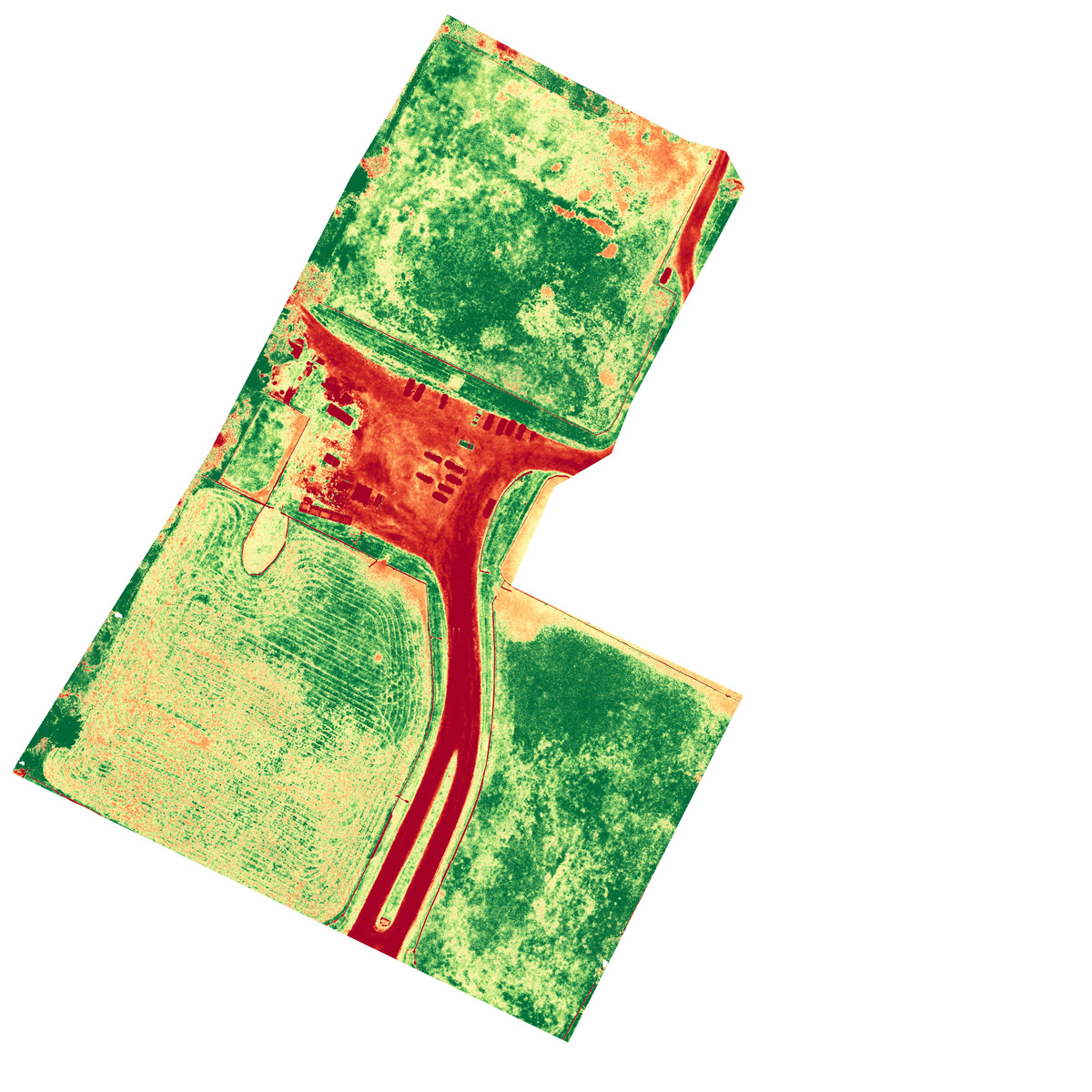
A crop health map of the same area.

An elevation map of the area.
I was particularly impressed by the crop health map; all manmade areas are in red or orange, while areas of dried grass show up as less green or yellow compared to the healthier spots; you can notice how good the correspondence is by comparing it to the 2D or 3D map. The utility is very real for agricultural professionals and related industries. DroneDeploy has a free plan that allows you five map generations a month. Try it for yourself here.


I don't always fly a drone, but when I do.. Never mind
This program alone almost justifies the purchase of a drone. Hats Off!
I wonder if you could take the models into After Effects.. what's the resolution like?