
Besides your camera, your phone is probably the most important tool for a successful photography trip. So if your laptop was stolen, could you get by with your smartphone? Would it be handicapped without a cellular connection?
For digital nomads working and shooting on the go, losing a device or just an Internet connection can lead to some difficult pickles. Luckily there are great offline-friendly apps that use cloud backups so your device, and not your sanity, is the only thing that croaks.
Of course, make sure you have a solid 3-2-1 backup plan and reliable equipment before you hit the road. Redundant backups and the right equipment will help prevent crises, or at least minimize their impact.
Here are 10 apps to enhance your next photography trip and provide peace of mind, and most of them are free.
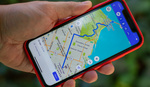
1. Google Maps
Navigating with a solid data connection may be a given in the urban sprawls, but overseas is another story. Your cellular provider may charge an exorbitant rate for international roaming (I’m looking at you, AT&T). Even if you pick up a local SIM card, it’s no help to you in the Alps or Yosemite.
I can’t count how many times in Scotland I would load up a route on hotel Wi-Fi, get halfway to my next destination, and discover the preloaded route vanished. So when Google Maps added support for offline maps, my biggest travel pain point disappeared.

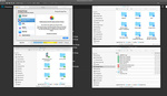
Downloading offline maps in Google Maps.
There’s one catch: offline directions don’t work with route options like “no highways,” so if you’re trying to avoid the well-traveled road effect, you will still need to queue up the route when you have a connection.
2. GeotagPhotos
My Canon 5D Mark III doesn’t have onboard geotagging. Sure, I could use Canon’s bulky GP-E2 module, but that’s almost as insane as packing a dedicated shutter release (you are using Magic Lantern’s bulb timer, right?)
Luckily, you already have a GPS-equipped device: your phone. The GeotagPhotos app does a phenomenal job continuously tracking my location for weeks at a time with impressively little battery drain. I’m still using the original version which is an eyesore, but version 2 looks great.
Unlike a dedicated GPS camera module, GeotagPhotos tracks the entire trip, not just when you snap a photo. This is great metadata for journaling and backtracking previous routes.

Geotag your photos in Lightroom with GPX tracklog.
GeotagPhotos exports GPX files to Dropbox, which load flawlessly into Lightroom. So long as your camera’s clock was correct, you can tag all your trip’s photos in a few clicks.
3. PhotoPills
I’m definitely not a pro user, but PhotoPills is a fantastic companion app for landscape photography. When scouting a location, the augmented reality (AR) mode helps me determine if the lighting at twilight will be worth shooting.
You can use PhotoPills to plan complex astrophotography shots, but the AR mode and offline-friendly list of twilight times alone justify the cost.
I’ve have run into one minor hurdle. The AR mode relies on your phone’s compass, so if your fingerless gloves have magnets in them like my Vallerret photography gloves, you’ll have to take them off first.
4. 1Password
Your IT friends have probably sung the praises of a password manager like 1Password, but did you know it’s a fantastic way to securely back up your passport, IDs, and credit cards?
I sync my encrypted password vault over Dropbox. Anywhere I can access the Internet, I can securely access my passwords and travel documents. If I lose my passport, I can pull up a photocopy on my phone without an Internet connection. If my phone also disappears, I can access the vault on Dropbox with any Internet-connected device.
Oh, and of course it’s great for storing your passwords.
5. Google Translate
Learning a new language before a trip is fun. Being unable to read road signs or ATM instructions is not.
Google acquired the incredible Word Lens app and integrated it directly into Google Translate. Just point your phone’s camera at some text, and it will translate the text in realtime without an Internet connection.
Google Translate with the camera, previously Word Lens.
The rest of Google Translate is essential as well. I keep offline versions of German, Italian, and Spanish downloaded so I can manage a mildly intelligible dialogue even when there is no cellular connection.
6. TripIt
“Have I booked a B&B for the day after tomorrow?” For a 1 to 2 week trip, you can book all accommodations ahead of time, but as a digital nomad your next destination may be TBD, and digging through starred emails diluted by cancellations is frustrating.
TripIt is my one stop for cataloguing travel reservations: flights, car rentals, accommodations, and tickets. Just forward a confirmation email, and the reservation is automatically imported to the TripIt website and app for offline access. No need to panic when you lose cellular and can’t find the address for your next B&B.
My one complaint is that the site feels clunky for managing longer trips. Updating or rebooking accommodations takes too many clicks, so I would love a better single-page app experience on the website. Copy-pasting reservation details like an address or phone number from the app is also bit unintuitive.
7. White Noise
Sometimes you end up on “that floor” at a hotel: the window faces a noisy street, the AC loudly switches on, or a football team checks in at midnight.
The White Noise Ambience app turns my phone into a noisemaker. I grew up falling asleep to the sound of a fan, but the app has a variety of background noises like purring cats and trickling brooks. The app is an eyesore, but I don’t usually look at the screen in my sleep.
Just make sure your phone is plugged in, or it will drain your battery before morning.
8. Google Voice
International calls are expensive. When I was in an car accident overseas, I had to place several lengthy calls to insurance companies and nearby car rental agencies.
I would have easily racked up $100 in cellular charges, but luckily I had a solid Wi-Fi connection, so I made those calls with Google Voice via the Hangouts app. I purchased $10 worth of Google Voice minutes and only spent $5 for 40 minutes of call time from my B&B (which coincidentally had no cell connection). Depending on the carrier, that would have been a $20–$200 bill.
The rates are hard to beat: the most expensive call was 15 cents per minute, but the rest were 2 cents. And my frequent calls to my insurance company in the U.S. were free.
9. Dropbox
I back up scans, photos, reservations, and other paperwork in Dropbox. For especially important travel documents, you can make them “available offline” on your phone.

Make files available offline in Dropbox.
Dropbox is also a great place to throw road sign and travel guides, though I usually import those directly into iBooks for faster viewing.
10. Scanner Pro
Paperwork has a way of hunting travelers down. If you’re reporting your expenses for a business trip, managing freelance paperwork, or just trying to find a place for an old rental agreement, Scanner Pro is an easy way to digitize documents with scanner-like precision.

Digitize documents with Scanner Pro.
When you’re done, you can upload the scans directly to Dropbox for a quick backup.
What’s Your Favorite Travel App?
Digital nomads place non-trivial constraints on software, and photographers more so as they travel to off-the-grid locations.
The recurring theme in these apps is their fabulous offline experience and automatic online backups. When you’re stranded without an Internet connection, your data will still be accessible. Worse, if your laptop or phone is snatched, your information will be safely backed up in the cloud for easy access.
Did I miss your favorite travel app? Let me know in the comments, especially if it’s offline and cloud friendly.
Lead image by Oleg Magni via Pexels.


Number 10 is a bit redundant when Dropbox already includes a perfectly good document scanner within it's own app...
A friend just mentioned this to me, I'll have to try it out!
I had no idea. Thanks!
I'm no "digital nomad" (groan), but some of my favorite apps for photography while traveling or making plans are:
1. The Photographer's Ephemeris for keeping tabs on sun/shadow position (better than Photo Pills for those kind of features). Has a cool AR feature. Also, there's a subscription feature to track how vivid a sunset might be at a time/place.
2. Sky Guide for tracking stars & moon positions (also has a cool AR feature).
3. Airmap is essential for keeping tabs on where you can and can't fly a drone
4. TPE 3D is really cool, albeit somewhat crude, for predicting how light will fall on a landscape. It pulls 3D geographical data from an area and models how the light will fall on it at any time of day.
5. Photo Transit is extremely useful for deciding which kind of lens to grab as it will show you the FOV a certain focal length will encompass on a map. It can even simulate the effect if theres a google street view available at your shooting location.
I should say, I'm on iOS. Not sure if any of these apps are available on Android.
Great suggestions! TPE 3D looks like black magic. Have some of those apps in particular helped you plan a shot you wouldn't have otherwise captured?
Yes! I was able to get this shot of horseshoe bend as the milky way passed over the middle using TPE 3D. Using the app I knew the exact time to be there. It was glorious—no one else there at 4 AM! I just wish I had been better prepared to shoot in that low of light...
That's an incredible shot, Colin! PhotoPills has a feature like that too, can't wait to try some more astrophotography.
PhotoPills has a 3D light planner?! Where I do I find this in the app?
Ah, not specifically 3D light planning, but it shows you in 3D where the milky way, sun and moon are!
Ah right, I thought I was missing something then! Looks like I might have to buy this 3D app, cheers Colin.
Terrific list. Thanks!
I am a traveling nomad who takes pictures while roaming for work. Geotag Photos 2 is the best app. As of 2017 I travel with a Canon G9X mkII (used to travel with a 7D, Canon S100 and S120 and rent on occasion 5DSR) and this app really works. I have had problems with the GPX files and Lightroom but it can tag almost any format of file.I tag my original JPG and CR2 files with geolocation and then import in to LR (yes, I tag copies of the files, never the ‘masters’). In this article I use 1, 2, 4, 5, and 6. Google Maps is the #1 app. Just back back from 6-month business trip to Europe to include Brussels, Paris, Amsterdam, Venice, Florence, Pisa, Rome, Naples and Amalfi Coast. Took thousands of shots while using these apps. I travel with an iPhone 8 Plus and iPad. I have a work Windows computer but cant use it for photo’s (locked down for SD cards and USB devices).
I would add to the list Amazon Prime Photos.
Google Maps gets better every trip I take; the Terrain view is killer for finding potential landscape photography spots. It definitely earns #1!
The 3D view in Apple Maps works well too. Sometimes better resolution than Google. Worth trying both.
Now if Apple Maps just had an offline mode... :)
This 30 year travel photographer thinks citymaps2go is the best travel app. Super detailed downloadable maps that tell you exactly where you are in the world without using data. If your signal is bad google maps is useless.
Thanks for the recommend! Are there any major limitations on the free version?
And how would you compare CityMaps2Go with Google Maps' offline mode?
You need to download the maps while online or on wifi. I think the free version only gives you 2 maps and it's unlimited for the paid. If you have no service/data/wifi google maps won't zoom in to where you are. CM2G will show where you are anywhere in the world down to a back alley in Paris or Bangkok.
Hmm, you might check Google Maps offline mode again—it lets me download an entire region and zoom in all the way, down to alleys :)
I love the iOS app: Magic Hour https://itunes.apple.com/us/app/magic-hour/id482426006?mt=8
I stumbled upon this app when I was traveling to Yosemite National Park for this shoot: http://www.lelham.com/shaun-melanie-yosemite/
I had never been here before and had heard that lighting was difficult due to the sun hiding behind the mountains at certain places. But this app really helped me with timing.
I also thing the podcast app is a good must have app.
What a backdrop for a photoshoot! How does the app help with the mountain trickiness? Or is that still up to you to figure out?
It has a visual of the suns angle. I still had to figure it out myself but being able to see the angle really helped me figure out when we should be starting in the valley and then later headed up to the mountains as the sun started to set.
Ah, makes sense. I wonder if there's a great app that incorporates the Terrain view data in Google Maps to predict the angle of light at a given location + altitude. TPE 3D might be the answer...
Priorities priorities... Foursquare & Opentable.
Someday someone will come up with a great app for finding great coffee cafés and pubs which may trump those two above.
For those of us who get really frustrated with traffic and such frustration leads to bad shoots... Waze!
I definitely need the coffee app! I suspect Google's Yelp powered reviews are gonna trump a dedicated app, but this AirBnB-style app delights my inner coffee nerd:
https://itunes.apple.com/us/app/best-coffee-cafes-guide/id400916958?mt=8
Thanks, Jonathan! It's a really nice post. I focus on the budget so I also install Agoda for accommodation, Yelp for food, free Cyclonis Password Manager instead of 1Password, and store a bunch on Dropbox.
Glad it was useful, Rene! Hadn't heard of Cyclonis, is there a good mobile app as well?