
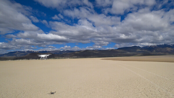
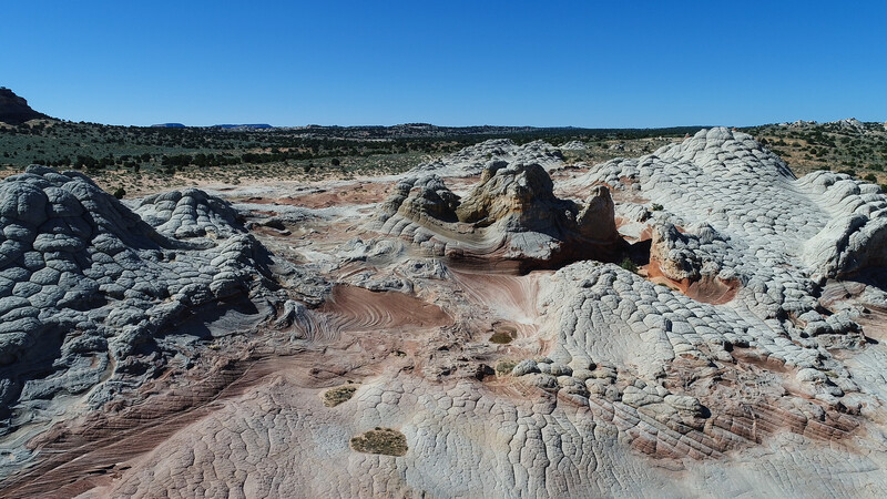
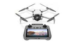
Where you can or cannot fly a drone when it comes to United States public lands is a confusing topic with an answer that has to be pieced together by studying multiple government websites. Navigating the gauntlet of online information can be daunting but I'm here to help. In an article that I published a few weeks ago on Fstoppers, I included an image I captured with my DJI Phantom 4 Pro above White Pocket in northern Arizona. One of our readers commented that he thought it was illegal to fly a drone in the Vermilion Cliffs National Monument. In fact, it is not. If you are a drone owner, you are likely aware that you cannot take off or land from any public lands managed by the National Park Service.
Many National Monuments and other public lands are managed by the National Park Service, but the Vermilion Cliffs National Monument is actually managed by the Bureau of Land Management. Since the Bureau of Land Management allows recreational drone use on most of the lands it manages, I was good to fly. Perhaps “allows” is the wrong thinking and it should be more like “they don’t restrict the use of.” Wouldn't it be nice if there was a hard and fast rule for all of us that says you cannot take off or land on public lands managed by the National Park Service, but you are free to fly on lands managed by the Bureau of Land Management? Unfortunately, it isn’t quite that cut and dry. Spending a few minutes to better understand the rules can potentially save you from a big fine or even jail time. Let’s dig a little deeper.
A Brief Disclaimer
First things first, please be aware that what I am writing about only pertains to the recreational use of drones under United States public law 112-95 (section 336) and the Federal Aviation Administration’s interpretation of that law under 14 CFR Part 91. If you use drones (or small Unmanned Aircraft Systems, aka sUAS’s) for business purposes, those rules fall under Part 107 of the Federal Aircraft Regulations and are not covered here.
What are Public Lands
To help get your head around the situation, it is probably good to have a common understanding of what constitutes a United States public land. Public lands are land held in trust for the American people by the federal government and managed by the Bureau of Land Management, the United States National Park Service, the Bureau of Reclamation, the Fish and Wildlife Service under the Department of the Interior, or the United States Forest Service under the Department of Agriculture. They fall into categories as defined by the U.S. Department of the Interior including National Parks, National Forests, National Wildlife Refuges, National Conservation Areas, National Monuments, Wilderness Areas, National Historic Sites, National Memorials, National Battlefields, National Recreation Areas, Wild and Scenic Rivers, National Seashores, National Lakeshores, National Preserves, National Cemeteries, and National Trails. The specific use of public lands varies but they are typically set aside for historical value, conservation, recreation, and livestock grazing. With few exceptions (e.g., the 1906 Antiquities Act/National Monuments Act), only Congress has the authority to create or acquire public lands.
As I discussed above, the challenge isn’t as simple as knowing which of these public lands are managed by the National Park Service and which are managed by the Bureau of Land Management. For example, National Forests are entirely managed by the U.S. Forest Service. Here’s another, some National Monuments are managed by the National Park Service and some are managed by the Bureau of Land Management. As if that isn't confusing enough, the National Wild and Scenic Rivers are managed by a four-agency coordinating council that includes the Bureau of Land Management, the National Park Service, the U.S. Fish and Wildlife Service, and the U.S. Forest Service.
Don't Fly in National Park Service Managed Lands
So, let’s simplify things straight away since there is one rule of thumb for all of these areas that makes it somewhat easier to determine if it is okay to fly. That is, if the public land is managed by the National Park Service, you cannot take off or land from there. Some people will try to skirt the law by taking off and landing right outside the park boundary. In most cases, they rapidly fall into non-compliance because they will likely have to fly their bird outside of visual range, which is a no-no per the FAA interpretation. With this rule in mind, here’s a breakdown of the public lands that are completely or partially under National Park Service management:
1. National Parks – 60 of 60
2. National Forests – 0 of 154 (U.S. Forest Service)
3. National Wildlife Refuges – 0 of 562 (U.S. Fish and Wildlife Service)
4. National Conservation Areas – 0 of 16 (Bureau of Land Management)
5. National Monuments – 88 of 129 (41 under management of 5 other Federal agencies)
6. Wilderness Areas – 60 of 765 (705 under management of 3 other Federal agencies)
7. National Historic Sites – 78 of 89 (11 affiliated sites that may or may not be managed directly by the National Park Service)
8. National Memorials – 29 of 29 (5 affiliated sites that may or may not be managed directly by the National Park Service)
9. National Battlefields – 25 of 25
10. National Recreation Areas – 18 of 21 (3 under management by the U.S. Forest Service)
11. Wild and Scenic Rivers – 5 National Rivers and 10 Wild and Scenic Rivers
12. National Seashores – 10 of 10
13. National Lakeshores – 4 of 4
14. National Preserves – 21 of 21
15. National Reserves – 3 of 3
16. National Cemeteries – 14 of 147 (131 under management of U.S. Department of Veteran Affairs and 2 under management of the U.S. Army)
17. National Trails – 23 of 23
Flying on Other Public Lands
The Bureau of Land Management and the U.S. Forest Service actually make it somewhat easy to figure out if recreational drone fight is allowed. They both have fundamentally deferred to the Federal Aviation Administration saying that the FAA has authority over all airspace. Local exceptions may be in place so if you see a park ranger, it is always a good idea to double check. Besides following the Federal Aviation Administration rules, these agencies also ask that you:
- Do not fly over congressionally designated Wilderness Areas or Primitive Areas as many people seek these places for the opportunities for solitude and quiet that they provide.
- Do not fly over or near wildlife as this can create stress that may cause significant harm, and even death. Intentional disturbance of animals during breeding, nesting, rearing of young, or other critical life history functions is not allowed unless approved by research or management.
- Follow state wildlife and fish agency regulations on the use of UAS to search for or detect wildlife and fish.
- Launch your UAS more than 100 meters (328 feet) from wildlife. Do not approach animals or birds vertically with your UAS.
- Never fly your UAS over or in close proximity to any fire (wildfire or prescribed) or search and rescue operation. UAS flights over fire operations disrupt aerial firefighting operations and create hazardous situations.
- Federal agencies regularly fly aircraft at low altitudes to perform natural resource management. It is the UAS Operator’s responsibility to be aware of these flights and take the steps necessary to avoid them. Contact the local Ranger District Office or the Federal Aviation Administration for scheduled flights in the area.
The United States government is very clear that taking off and landing from designated Wilderness Areas is forbidden since no mechanized equipment is permitted in those areas. Remember the White Pocket example that I started out with? Even though it is in a National Monument where flying is okay, it is also right on the edge of a designated Wilderness Area. I consulted more than one map before I flew just to be certain that I was in the clear. One nuance to know about this designation is that there is also a category of public land called a “Wilderness Study Area.” It has many of the same features as a Wilderness Area but has not been officially designated as such by Congress. Unless posted, you are permitted to take off an land from Wilderness Study Areas.
As for state and city parks, the rules for drones are really on a case-by-case basis. You should check their website and ask park officials before taking off. Don’t rely on “asking for forgiveness,” get permission first. If you don’t get an explicit “it’s okay to fly,” then keep your drone on the ground and just enjoy the scenery. If you are visiting public lands and are unsure of its status for any reason, I have the same advice, go to their website first. If you see the National Park Service badge on the page, you can be certain that you cannot fly there. Otherwise, as with local parks, ask an official if it is okay to take to the sky. There are also a number of apps that you should consider having on hand at all times that will help you know if an area is safe or not. The official one from the Federal Aviation Administration is called B4UFly. Many experienced drone pilots prefer apps such as AirMap or Hover to understand flight restrictions and other important information prior to taking off.
Just Because You Can Doesn't Mean You Should
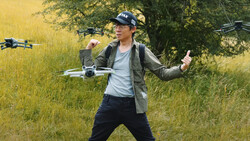
I’ve spent a lot of time talking about whether you can legally fly your drone in public lands and hopefully I have clarified things for you. The other question you have to ask yourself is just because you can fly, should you fly? When the reader asked me about White Pocket, I made sure to tell them that even though I was permitted to fly I still did as much as I could to not impact others who were in the area. On that particular day, there was one couple and one individual camping in the parking area and I asked each of them if they would mind if I flew. I also drove over to a more distant parking area so that there would be less noise disturbance. And, I waited to fly until the sun was fairly high up so as not to bother anyone else who might be doing photography at sunrise. A little common sense and courtesy to others can go a long way towards making your flying experience more fun while helping to get folks more comfortable with our drones buzzing around in the sky.


Join the Fstoppers community for free
-
Post comments and join in the discussions
-
Browse the site ad-free
-
Share your work and get featured in the community
-
Compete in the photo contests for fun and prizes
25 Comments
This is exactly why I sold mine, and will not purchase another drone. Too Restricting! This world is getting to be a Pain in the ASS for Photographers/Videographers.
One of the take aways from my article certainly is on the amount of restrictions there are, some rightly so, others not so much. But another take away is that there is a lot of beautiful country to fly over that is still accessible to recreational drone pilots. You just need to know where to go.
For me, I hate having to spend time trying to decipher all these ridiculous, overbearing regulations where the hell I can operate a Drone. Once they outlawed the NP's, I was done with them. I think, that NP's should set up limited daily use with registered permits, then it's fair to everyone.
Do you have a source on your use of drones in Wilderness Study Areas? That would come as a surprise to me if true. WSAs are managed as Wilderness, though occasionally there are specific exceptions. I am not aware of any exceptions made for drones. In general practice, WSAs are managed exactly the same as congressionally designated Wilderness, this includes regulations related to "mechanical transport" as defined in the Wilderness Act.
Please refer to BLM Policy Manual 6330 (https://www.blm.gov/sites/blm.gov/files/uploads/mediacenter_blmpolicyma…) which details the policy for the management of Wilderness Study Areas. The first thing to note is section 1.6.C (page 1-10), which discusses the non-impairments standard per the policy. In this section, besides the definition of non-impairment, you will find the following verbiage, "Management to the non-impairment standard does not mean that the lands will be managed as though they had already been designated as wilderness. Some uses that could not take place in a designated wilderness area may be permitted under the WSA Management Manual. For example, in many cases it is permissible use motorized vehicles on some primitive routes in WSAs, while such vehicles are prohibited in designated wilderness under the Wilderness Act." What this says is that WSA's are not necessarily managed the same as designated Wilderness Areas.
Further, if you refer to section 1.6.D.6.f, (page 1-30) you will find the Policy for Specific Use - Recreation - Aerial Activities. Again, while not specifically referring to drones, it states, "Aerial activities such as ballooning, hang gliding, paragliding and parachuting (sky diving), may be allowed as long as they meet the non-impairment standard, including not requiring cross-country use of motorized vehicles or mechanical devices to retrieve equipment, except in areas designated as “open” before October 21, 1976." Meaning aerial activities are permitted as long as they meet the non-impairment standard.
"you are permitted to take off an land from Wilderness Study Areas."
Please site your source because I'm positive that this is incorrect. WSA's inherit the same protections as designated wilderness areas until its status is determined by congress.
Please refer to BLM Policy Manual 6330 (https://www.blm.gov/sites/blm.gov/files/uploads/mediacenter_blmpolicyma…) which details the policy for the management of Wilderness Study Areas. The first thing to note is section 1.6.C (page 1-10), which discusses the non-impairments standard per the policy. In this section, besides the definition of non-impairment, you will find the following verbiage, "Management to the non-impairment standard does not mean that the lands will be managed as though they had already been designated as wilderness. Some uses that could not take place in a designated wilderness area may be permitted under the WSA Management Manual. For example, in many cases it is permissible use motorized vehicles on some primitive routes in WSAs, while such vehicles are prohibited in designated wilderness under the Wilderness Act." What this says is that WSA's are not necessarily managed the same as designated Wilderness Areas.
Further, if you refer to section 1.6.D.6.f, (page 1-30) you will find the Policy for Specific Use - Recreation - Aerial Activities. Again, while not specifically referring to drones, it states, "Aerial activities such as ballooning, hang gliding, paragliding and parachuting (sky diving), may be allowed as long as they meet the non-impairment standard, including not requiring cross-country use of motorized vehicles or mechanical devices to retrieve equipment, except in areas designated as “open” before October 21, 1976." Meaning aerial activities are permitted as long as they meet the non-impairment standard.
"Aerial activities such as ballooning, hang gliding, paragliding and parachuting (sky diving), may be allowed as long as they meet the non-impairment standard, including not requiring cross-country use of motorized vehicles or mechanical devices to retrieve equipment,"
Its obviously very confusing but these examples are all non-motorized. How exactly does a drone meet the exceptions of the non-impairment?
In the first paragraph, you'll see that I pointed out the policy specifically says motorized vehicles are permitted on WSA's. "Management to the non-impairment standard does not mean that the lands will be managed as though they had already been designated as wilderness. Some uses that could not take place in a designated wilderness area may be permitted under the WSA Management Manual. For example, in many cases it is permissible use MOTORIZED VEHICLES [emphasis mine] on some primitive routes in WSAs, while such vehicles are prohibited in designated wilderness under the Wilderness Act."
Your comment above is not pertaining to "exceptions of non-impairment", they are "policies for specific activities" (all of section D of Manual 6330). Impairment, according to the BLM, comes in two main flavors. 1. permanent structures, 2. surface disturbance. Flying a drone certainly doesn't involve #1 and should not involve #2. Specifically, any ground or vegetation that might be disturbed would not require any reclamation, rehabilitation, or restoration in order for the site to appear and function as it did prior to the disturbance.
Keep in mind, the BLM Manual 6330 was crafted in July 2012. Drones weren't nearly as much on the radar as they are now so the document doesn't specifically discuss them. It does discuss fixed wing aircraft and the fact that they can take off and land from a pre-existing airstrips in a WSA.
Steve, thanks for the the response. I still dont see anything that provides cut and dry "proof" that drones are legal in WSA's. It just seems to be an assumption based off your interpretation of the plethora of information provided.
The documentation you quoted says "on some primitive routes" how exactly does a drone follow a route that is more or less an old mining track within a WSA? Hover above it?
Well, here's the thing about WSA's. Basically, they don't have to have every activity that is permissible spelled out in a policy. In fact, the policy specifically states that the BLM will monitor the usage and if they see that a particular activity is causing "impairment" (in this case "surface disturbance"), then they will take steps to remedy it (probably by posting signs specifically showing that the activity is not permitted).
As for your comment about "on some primitive routes", how does a fixed wing aircraft fly over a WSA to land at a pre-existing airstrip? I'm certain it doesn't follow the mining tracks. :-) The point the BLM is making about staying on primitive roads goes back to impairment, they don't want the SURFACE DISTURBED. Unless you crash your drone and create a crater, the ground shouldn't be impacted from taking off and landing.
Again, the policy was written in 2012, before drones were a thing. What points me to drones being able to take off and land in a WSA is:
1. They do not cause impairment per the definition of the BLM
2. Motorized vehicles are allowed in WSA's
3. Fixed wing aircraft are permitted to take off and land on pre-existing airstrips in WSA's
4. Other aerial activities are permitted in WSA's
I have reached out to my contacts at the BLM to see if they have an official position on this topic.
The BLM or USFS has no jurisdiction on airspace. But they do have control over takeoff and landing. I am not a lawyer, so certainly my interpretation of these rules you posted may not be perfect, but these don't seem to clearly indicate drones can take off or land in WSAs. The rules are obviously not completely explicit, but the general rule of thumb for almost all WSAs is they are managed as Wilderness unless there is an exception, not the other way around. I am not aware of any WSAs here in Utah, for instance, where motorized vehicles are allowed.
Of course, a quick call to the BLM or USFS Field Office where you want to fly would also clear it up pretty quick. In my experience, WSAs have been out of bounds.
From the Utah BLM re: drone use (TL;DR - there are no specific BLM restrictions on drone use; there may be local restrictions for Wilderness/WSA so consult local office; and follow FAA guidelines):
"There is no specific BLM restriction for flying UAS (drones) for recreational purposes on most public lands.
Local offices may have restrictions pertaining to flights in Wilderness/Wilderness Study Areas (WSA). Recreational UAS users are encouraged to consult the local office prior to flying on public lands."
Also, from everything I can find online, motorized vehicles are allowed on trails and ways through Wilderness Study Areas that existed prior to the 1980 wilderness inventory. Of course, these could be closed if they are being overused and damaging the sustainability of the area as a potential Wilderness Area.
From the Oregon-Washington BLM re: drones in WSA's (TL;DR - there is no policy and the only place the BLM can control take offs and landings is in designated Wilderness Areas...not WSA's):
"Currently there's no specific policy on the use of drones in WSAs. That said, drone use can disturb an area's outstanding solitude and primitive recreation setting. It can also hinder recreation opportunities for others in the area. FAA rules require that the drone be within the sight of the pilot at all times.
We have no authority over airspace, so can only highly discourage overflights, but we can control take-offs and landings. These are prohibited inside a Wilderness area (and all internal primitive routes are closed to motorized and mechanized uses), and are prohibited off roads in OHV Closed or Limited areas outside the Wilderness area.
All of the other restrictions described for WSAs below apply, as well as FAA "line of sight" rules. The BLM has no authority over anything once off the ground."
Regarding your comment that they are managed the same. BLM Policy Manual 6330 explicitly says "Management to the non-impairment standard does not mean that the lands will be managed as though they had already been designated as wilderness. Some uses that could not take place in a designated wilderness area may be permitted under the WSA Management Manual.". Yet, you're saying they are managed the same as a designated Wilderness Area. Section 1.6.A.3 of 6330 goes on to say, "Designated wilderness is managed pursuant to the Wilderness Act, which states that these areas shall be administered to “preserve wilderness character.” For WSAs, FLPMA mandates that the BLM “not impair the suitability” of areas we have identified as “having wilderness characteristics.” This sentence, again, is saying that they are managed differently. Wilderness is managed by a specific act of congress whereas Wilderness Study Areas are managed to "non-impairment", meaning 1. no permanent structures and 2. do not disturb the surface beyond what is already there.
Also, regarding motorized vehicles through WSA's in Utah, I can tell you that the overland route across the GSENM from Big Water to Hole In The Rock Road crossed a few WSA's including Burning Hills WSA and Fifty Mile Mountain WSA. I drove it about 10 months ago, no issues from BLM (in fact, you need a back country permit so they know you are driving through and possibly camping).
Sorry, I think you misunderstand how a WSA boundary works.
Those routes in GSENM are cherrystemmed, meaning the roads are not actually in the WSA. Here's an example - the blue area is a WSA off Smoky Mountain Road, and you can clearly see the cherrystem. Motorized use on the road is fine, motorized use off the road is not.
Yep, my bad, you are right (about this particular part ).
This link is from the USFS, not the BLM, but it seems pretty clear that Wilderness and WSAs are treated the same - https://gacc.nifc.gov/nrcc/dispatch/aviation/USFS_UAS_Desk_Guide.pdf
I'm sorry but there is nothing in that link that shows that designated Wilderness Areas and Wilderness Study Areas are treated the same, even though the title may try to make it sound that way. Both the BLM and NFS attempt to tie Wilderness Area and Wilderness Study Area together through their wording but there is a key difference. Wilderness Areas are managed under an act of congress called the Wilderness Act. The boundaries of Wilderness Areas are clearly defined by statutory law. Wilderness Study Areas, on the other hand, are managed under the Federal Land Policy and Management Act (FLPMA) which gives federal agencies the mandate to keep the areas in a primitive state until they are either eventually designated a Wilderness Area by congress or they are put back to multi-use lands designation. You will notice that all of the points in your attachment talk about the Wilderness Act and none of them mention FLPMA. Why? Because there is no specific policy regarding drone use in WSA's (see other post with direct wording from the Utah BLM and the Oregon-Washington BLM.
Drones are now super small and might get even smaller, hard to spot. Same Mavic air is tinny. Hardly see it my self when I fly.
Must be not easy to catch.
Remember, the smaller they get, the less capabilities they will have (usually). Sure technology is advancing but there are physical limits on propellors, batteries, camera sensors, and lenses. Drones may be less and less likely to be caught but my point is more about doing what is legal and proper, not looking for ways to get around the law.
Here is a good rule: if an area you would be interested in flying over is somewhat beautiful, then you’re not allowed to fly your drone there.
Why can’t the drone pilots just fly over boring fields and be happy? And always maintaining the line of sight is so exciting; it means you have the radius of up to 600 feet, even though drones can go few miles out.
Technology progresses and restrictions get stricter. It’s like buying a $1K phone just for calling.
When the drones finally get completely noiseless, no one will notice violators any more and just chill the fuck out.
so, if you get a commercial license to fly a drone, you are able to fly anywhere?
No, in fact you are more restricted as you are flying under FAA Part 107 rules. No matter what your qualifications/certifications are, most of the lands managed by the National Park Service are off limits (National Parks, National Recreation Areas, many National Monuments, etc.). As a Part 107 Certified Pilot-In-Command, you must get FAA permission to fly in restricted airspace. This is the trade-off you have to make between flying for fun and flying for profit.
Funny, I stopped by the St. George BLM office today and the guy behind the desk (shirt said “volunteer”) said it was “probably a hard no” to fly a drone at white pockets. Probably a hard no? That’s like saying it’s a definite maybe. I explained to him that I have looked all over the place (hadn’t seen this article yet) and couldn’t find anything that restricted it. I know national parks and wilderness areas are off limits, but this is in neither. I asked if I could get a ticket for flying there, and he said it depends on the mood of the ranger that day. I asked what the ticket would be for since there isn’t anything that says I can’t, to which he said to ask the Kanab field office if I could fly (even though the St George office is technically over the area).
Honestly it felt more like an anti-drone person trying to arbitrarily limit where we can fly.
I’m not looking to bother others, and will do the same as you by not flying close to anyone.
Each agency must have clear-cut rules regarding where a drone can and cannot be flown, if they wish to enforce it. So the obvious thing to do is to provide us (and/or drone manufacturers) with files designating no-fly zones. Then, we wouldn't have to be constantly scared whether or not we could be fined $5,000 if we were to fly our drones in a particular location. The fact that such a map(s) does not exist, even on the Internet is a joke.