
Photography, at its essence, is a pursuit that is more than the mere act of capturing images; it is a journey into the heart of the world's hidden stories. In landscape photography, the scenery before our lenses often serves as a subject for stories written not by pen but by the patient hands of geological forces. This exploration takes us beyond the actual beauty of landscapes, urging us to unravel the details of Earth's geological history.
The history etched in rocks, shaped by oceans, volcanoes, deserts, and ice sheets, beckons us to delve into the question: how long did it take for these photographic locations to emerge, and should we immerse ourselves in researching the hidden wonders that lie beneath the surface? Let's head on a journey through time, where each photograph becomes a portal to Earth's hidden chapters, stories waiting to be told.
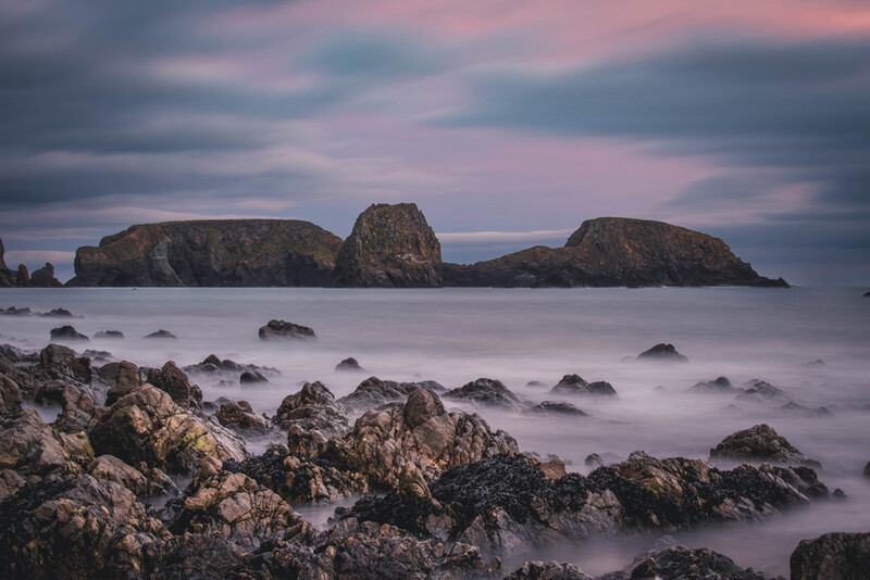
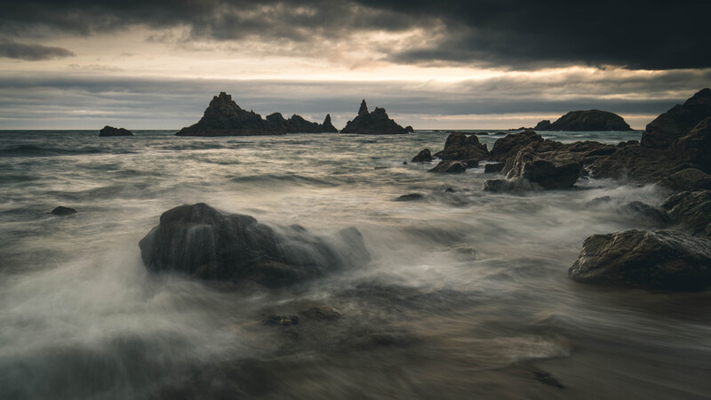
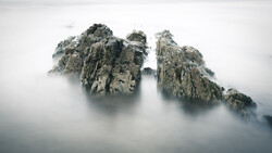
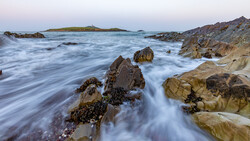
The area for my article is The Copper Coast in Ireland, which stands as a great example of the occurrence of natural forces over millennia. Spanning approximately 25 kilometers, this stunning coastline boasts scalloped beaches, hidden coves, and rocky headlands that tell a geological tale shaped by oceans, volcanoes, deserts, and ice sheets. I feel that we should delve into the history written in the rocks of the Copper Coast, asking the question: how long did it take for these photographic locations to sculpt themselves into the awe-inspiring landscapes we witness today? And more importantly, should we delve deeper into researching the geological wonders that grace this coastal gem, plus many others for that matter, all around the world?
Oceans, Volcanoes, Deserts, and Ice Sheets
Oceans
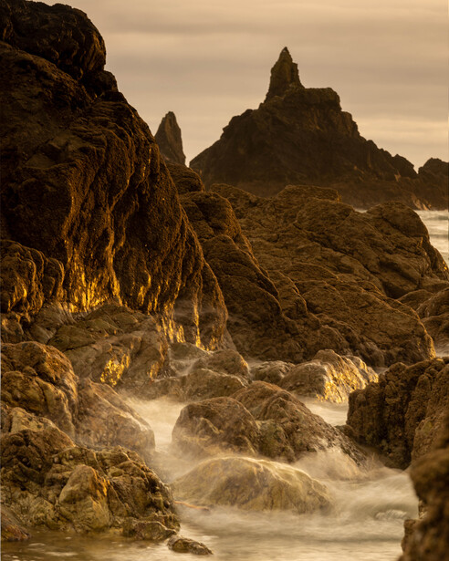
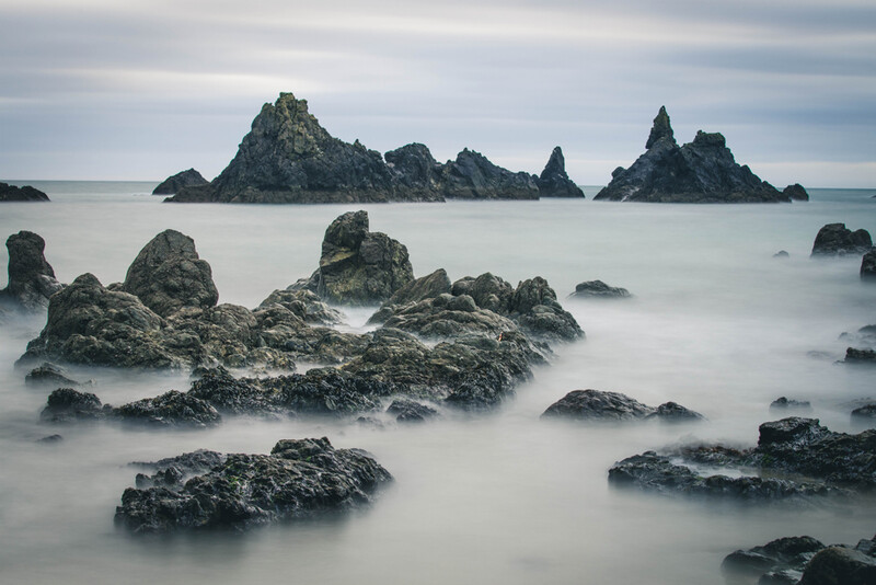
The relentless influence of the oceans orchestrated the geological battle that crafted the Copper Coast. Over millions of years, the ebb and flow of the seas sculpted the coastline, shaping cliffs, beaches, and secluded coves. The constant caress of the waves molded the rugged features that now define the visual canvas of the Copper Coast.
Volcanoes
Long before the Copper Coast adorned Ireland's landscape, volcanic activity played a crucial role in its formation. Molten lava surged from the depths, creating intricate rock formations that now stand as silent witnesses to the Earth's fiery breath. The volcanic legacy etched into the Copper Coast's cliffs and crags adds a dramatic dimension to its geological narrative.
Deserts
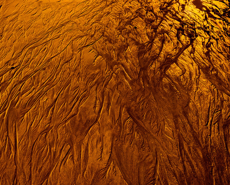
Desert landscapes may seem out of place in the context of Ireland's Copper Coast, but the story of deserts from its past is woven into its geological fabric. Wind-blown sands, carried across continents, settled in layers, forming unique rock formations. The interaction of desert sands and coastal elements contributed to the diverse textures and colors that captivate us photographers along this stretch of Irish coastline.
Ice Sheets
As the Earth underwent cycles of cooling and warming, ice sheets became protagonists in the drama of the Copper Coast. Glacial movements carved valleys, polished rocks, and left behind distinctive landforms. The scars of glacial choreography can be seen in the U-shaped valleys and smoothed surfaces that add a touch of ancient grandeur to the coastal scenery.
Millions of Years in the Making
The geological timeline of the Copper Coast spans an impressive expanse, stretching back millions of years. Each chapter in its journey is etched into the rocks, and understanding the temporal scale provides a profound appreciation for the enduring beauty we encounter today.
Erosion
Erosion, driven by the ceaseless action of wind and water, is a patient artist that has sculpted the Copper Coast over countless millennia. The rhythmic erosion of cliffs, the smoothing of rocks, and the creation of sea stacks and arches all bear witness to the gradual artistry of time.
Volcanic Episodes
The volcanic episodes that shaped the Copper Coast unfolded over hundreds of thousands to millions of years. From the initial outpouring of molten lava to the subsequent cooling and solidification, the volcanic chapters in the geological story reflect the dynamic creativity of the Earth's inner forces.
Desert Sands
The deposition of desert sands is a testament to the Earth's ability to overcome geographical boundaries over immense periods. The sands that found their way to the Copper Coast tell a story of transcontinental journeys and the enduring interplay between land and sea. Additionally, this part of Ireland was once at the equator, believe it or not.
Glacial Legacy
The influence of glacial movements on the Copper Coast spans epochs, with ice sheets advancing and retreating over vast stretches of time. These now form perfect subjects for us to photograph.
Should We Research More?
Understanding the geological tapestry of our landscapes enhances the photographic experience, in my opinion, providing a deeper appreciation for the landscapes that unfold before our lenses. Researching the geological history not only adds layers of knowledge but also allows us as photographers to capture the essence of time in our shots.
Photography With Context
Armed with knowledge about the geological processes that shaped each area, we can infuse their images with context. Each photograph becomes a visual story that goes beyond aesthetics, inviting viewers to contemplate the eons that contributed to the scene's creation.
Capturing Geological Diversity
Researching geological diversities enables us photographers to identify and capture a range of features. From volcanic rock formations to evidence of glacial sculpting, a well-informed photographer can create a visual catalog that showcases the rich array of geological elements.
Geological Impact on Flora and Fauna
The geological history of the area has a profound impact on its flora and fauna. Understanding these connections allows us to capture seasonal variations influenced by the underlying geological features, creating a comprehensive narrative that extends beyond the visual aspects. We can also see how native plants may have taken over from the originals over time.
Preservation and Conservation
Researching the geological background of the area fosters a sense of responsibility for its preservation. We can become advocates for conservation, using our art to highlight the importance of protecting these landscapes and the delicate balance of geological processes at play.
Interpreting Formations
Each rock formation speaks a language written in stone. Researching the geological context may empower us to interpret these formations, uncovering the stories of ancient oceans, volcanic eruptions, desert sands, and glacial movements embedded in the rocks.
Summary
The landscape is a living testament to the Earth's geological narrative. From the rhythmic erosion shaped by time to the explosive creativity of volcanic episodes and the transformative movement of ice sheets, every inch of many landscapes bears the fingerprints of the planet's tumultuous past.
As photographers, our journey becomes richer and more meaningful when we delve into the geological history that underlies its stunning landscapes. The rocks that form the physical foundations are not just static features; they are chapters in a dynamic story that unfolds over millions of years.
Should we research more? Absolutely. For in unlocking the geological tapestry, we discover not only the secrets of the land, but also a deeper connection to the timeless beauty that surrounds us.
The Copper Coast invites you on a journey through geological time. You can see an example of this on my headline video above.
Have you more to add to this article? Have you explored areas around you similar to this?
I’d love to hear your thoughts below in the comments. Let’s chat.


Join the Fstoppers community for free
-
Post comments and join in the discussions
-
Browse the site ad-free
-
Share your work and get featured in the community
-
Compete in the photo contests for fun and prizes
1 Comment
Slight correction:
"In landscape photography, the scenery before our lenses often serves as a subject for stories written not by pen but by the patient hand of God."
You're welcome.