Arriving at a photography location unprepared is frustrating, especially when the light or weather refuses to cooperate. Thankfully, several apps can significantly improve your planning, making the most of any location.
Coming to you from Andrea Livieri, this practical video outlines essential apps that can elevate how you prepare for your photography sessions. Livieri starts with PhotoPills, a comprehensive tool that merges various planning aspects, including precise sun, moon, and Milky Way positioning. The app is especially handy because it allows you to place virtual pins on maps, offering immediate visual insights into how natural light interacts with your chosen spot. Livieri showcases the planner module, highlighting how easily you can adjust your viewpoint, predict shadow lengths, and check elevation differences—all critical for accurate landscape photography. Its augmented reality mode even provides a real-time view of celestial paths, enabling better anticipation of ideal shooting times.
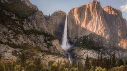
Next up, Livieri introduces The Photographer's Ephemeris, an app that goes beyond typical map overlays by incorporating three-dimensional terrain visualization. This feature uniquely shows how sunlight will interact with the landscape from your exact perspective. By adjusting dates and times, you can simulate lighting conditions throughout the day, accurately predicting when and how the sun will illuminate specific subjects or features. Livieri notes that the 3D visualization closely mirrors actual photography conditions, making it particularly valuable in mountainous areas where elevation dramatically affects lighting. Using it alongside PhotoPills offers complementary strengths, combining precise planning with immersive visualization to enhance your photography process significantly.
Livieri also discusses Peak Visor, an app specializing in mountain photography planning. It identifies mountain peaks directly through your phone's camera, displaying detailed 3D maps and terrain models. Livieri finds Peak Visor essential for scouting remote mountain locations virtually, exploring new viewpoints, and previewing hiking trails. Its offline functionality ensures reliable performance even in remote regions without mobile coverage. This practical capability means that critical geographic information remains accessible exactly when you need it most—on location. Peak Visor helps you understand the landscape intimately, guiding your decisions about where and how to capture dramatic mountain scenes effectively. That's just the start, sheck out the video above for the full rundown from Livieri.


Join the Fstoppers community for free
-
Post comments and join in the discussions
-
Browse the site ad-free
-
Share your work and get featured in the community
-
Compete in the photo contests for fun and prizes
No comments yet