
On July 6, 1989, physicists at the University of Minnesota aimed a low-light video camera at a distant thunderstorm to test the equipment and accidentally caught the first image of what is now called a red sprite, a burst of lightning firing upward toward space. That first frame was black and white and only proved the flashes were real; their crimson color would not be captured on camera until the mid-1990s. For most of the previous century, pilots who reported those flashes were told they had imagined them. Some of the atmosphere's most photogenic events are exactly that rare, that brief, and until recently that easy to dismiss.
As a professional meteorologist, I spend a lot of time explaining why the sky does what it does, and the ten events below are the ones I would most want in a portfolio and least expect to actually catch. The odds range from a clear evening at the beach to something close to winning a lottery you cannot buy a ticket for. They are ranked roughly from best odds to worst, with the physics, how each has been photographed, and where you would go to try.
The Green Flash: Your Best Odds on This List
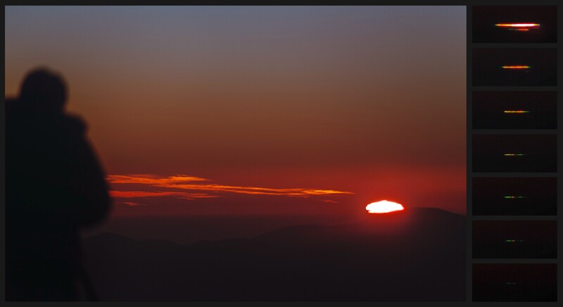
The green flash is the one rare phenomenon you can realistically plan for. As the sun's last sliver drops below a clean horizon, the atmosphere bends its light like a weak prism and spreads the disc into stacked colors. Blue scatters away, so the final color left standing for a second or two is green. You need a sharp, unobstructed horizon, which is why the ocean is the classic setting, plus clear, haze-free, stable air with no low cloud bank in the way. It fires at sunrise too, though a sunset is easier to plan because you can watch it coming.
Kelvin-Helmholtz Waves: A Minute of Breaking Sky
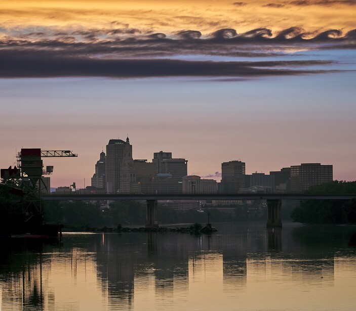
Kelvin-Helmholtz clouds, formally called fluctus, look like a row of ocean waves frozen mid-curl. They form when two layers of air slide past each other at different speeds across a stable boundary, usually a temperature inversion. The faster air on top drags the cloud tops over until they roll and break like surf. The structure is gorgeous and almost never lasts more than a minute or two before it smears out, which is why a well-defined fluctus is a prize among cloud collectors. Your best move is simple sky awareness on windy days with layered cloud. If you see the wave shape starting, shoot immediately and shoot wide, because by the time you change a lens the crests are gone. It is one of the few entries here that rewards nothing but attention and a camera already in your hand.
Light Pillars: Most Dramatic in Deep Cold
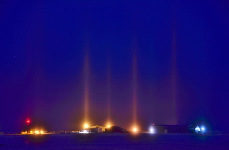
On brutally cold, calm nights, vertical columns of light can rise from streetlights, headlights, or the setting sun. They are not beams. They are the collected reflections from countless flat, plate-shaped ice crystals drifting down through the air like tiny falling dinner plates, each one a level mirror bouncing light back to your eye. The brightest, most dramatic version, the pillars that rise from streetlights and headlights, needs genuinely cold air, often below about 14 degrees Fahrenheit (minus 10 degrees Celsius), calm conditions so the crystals stay horizontal, suspended ice or diamond dust, and a bright light source. It is not strictly a cold-cities-only phenomenon, though: sun pillars can form wherever plate-shaped ice crystals drift in high cirrus, so they turn up over temperate regions too. Your camera will often record more color than your eye does, since each pillar takes on the hue of whatever light feeds it. If you live somewhere that gets deep winter cold, the vivid nighttime version is one of the more attainable entries on this list.
St. Elmo's Fire: Mostly for Sailors, Pilots, and Climbers
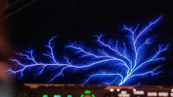
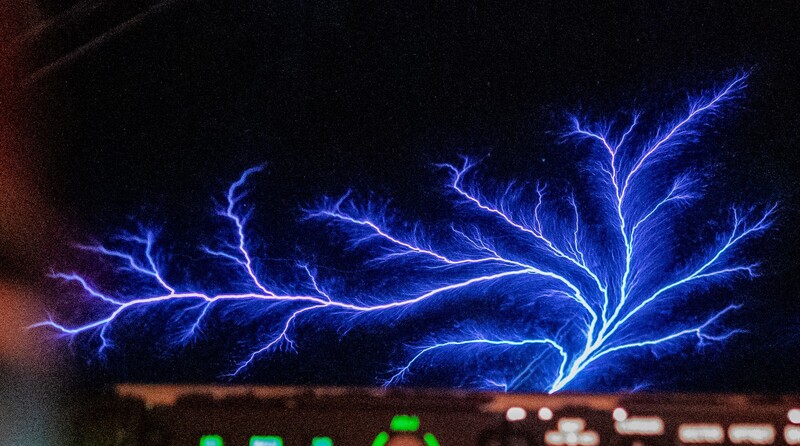
St. Elmo's fire is a blue or violet glow that clings to pointed objects during electrically charged weather. It is a corona discharge, a continuous plasma that forms when the electric field concentrated around a sharp point grows strong enough to tear apart the nearby air molecules and make them glow. A pointed object like a mast or a wingtip intensifies the local field enormously, which is why the glow clings there rather than forming in open air even when the wider atmosphere is nowhere near breaking down. Sailors watched it dance on masts for centuries and named it for Erasmus of Formia, the patron saint of sailors. Today it shows up most on aircraft windshields and wingtips, ship rigging, and the ice axes and gear of mountaineers caught near a storm. Unlike lightning, it can hold for minutes and often hisses or crackles. That makes it photographable when it appears, but appearing at all usually requires you to be somewhere exposed and slightly dangerous, which keeps most people's odds low.
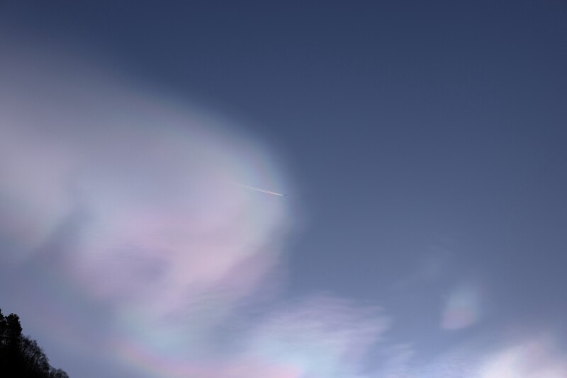
Nacreous Clouds: A Winter Reward for High Latitudes
Nacreous clouds, also called polar stratospheric clouds or mother-of-pearl clouds, glow in soft iridescent pastels after sunset and before dawn. They form 9 to 16 miles up, between 15 and 25 kilometers, far higher than ordinary weather clouds, in bitterly cold stratospheric air. At that height they stay lit long after the ground has gone dark, which is why they seem to shine from within. Their iridescence comes from light diffracting through unusually uniform, tiny ice particles, and the most vivid mother-of-pearl displays are a form made of pure water ice that requires the coldest stratospheric air, around minus 85 degrees Celsius. They favor the polar winter and turn up most often over Antarctica, Scandinavia, Scotland, Alaska, and northern Canada, so your latitude and the season decide your odds more than any gear does. If you are not in the high latitudes in deep winter, plan a trip, because the Royal Meteorological Society notes they are rare even where they occur.
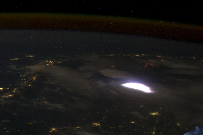
Red Sprites and Gigantic Jets: Lightning That Fires Toward Space
Above a strong thunderstorm, lightning does not only strike down. Red sprites flash in the mesosphere high above the storm tops, spanning altitudes of roughly 50 to 90 kilometers in a fraction of a second. Their bigger cousins, gigantic jets, climb even farther, punching all the way to the base of the ionosphere near 90 kilometers, a link first documented in the early 2000s. Both were long dismissed as pilot hallucinations until that 1989 accident put a sprite on video, with the scientific paper following the next year. The good news for photographers is that these are now within amateur reach. You want a dark sky, a clear line of sight toward a powerful storm sitting 60 to 200 miles away, and a fast camera running long or continuous exposures aimed just above the storm tops. A high-sensitivity body like the Sony a7S III paired with a fast lens is a common rig for this, and the same night-sky discipline taught in Elia Locardi's astrophotography course transfers directly. Amateur storm shooters now catch sprites regularly, but you still need the right storm, a dark foreground, and patience.
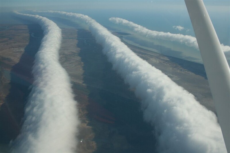
The Morning Glory: One Town, One Season
The Morning Glory is a roll cloud so long and clean it looks manufactured, a smooth tube that can stretch up to 1,000 kilometers and rolls low over the land, often only 100 to 200 meters up. It forms when sea breezes over Queensland's Cape York Peninsula collide, then feed a wave of air that travels under a temperature inversion overnight. The Gulf of Carpentaria in northern Australia, around the town of Burketown, is the world's best-known location where it appears regularly enough to plan a shoot around, from late September into early November. Glider pilots gather there to surf it. For a photographer, the appeal is that your odds go from slim almost anywhere else to genuinely good if you show up in that window and get up before dawn. It is the rare entry on this list that rewards buying a plane ticket.
Volcanic Lightning: Chase the Eruption
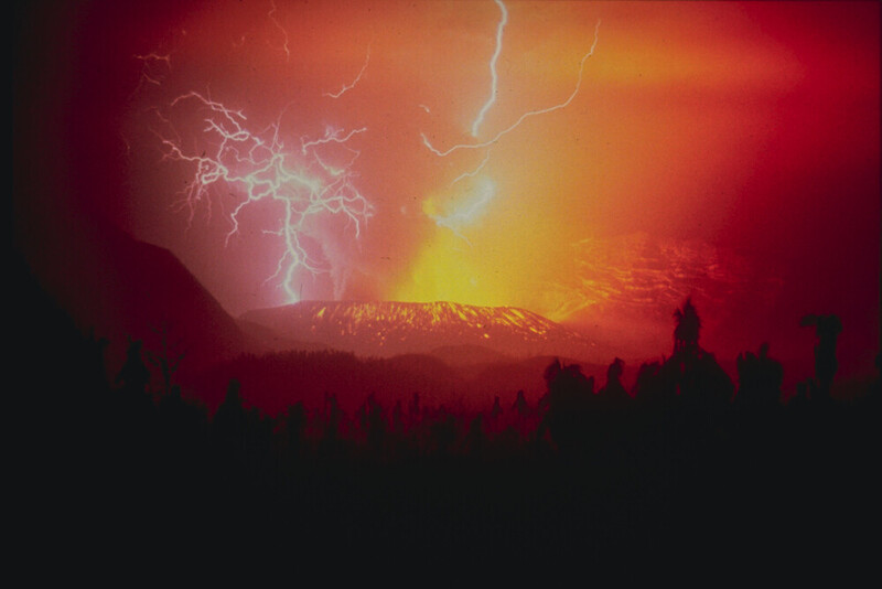
When a volcano throws a column of ash and shattered rock into the sky, that plume can generate its own lightning, a spectacle sometimes called a dirty thunderstorm. Down low near the vent, colliding rock fragments strip charge from one another. Once the eruption plume is past the freezing level, ice does the charging much as it does in an ordinary storm. During the 2010 eruption of Iceland's Eyjafjallajokull, detection networks logged hundreds of discharges from a fairly modest plume. The obvious problem is that you need an active explosive eruption and a safe vantage at night, which is why photographers who specialize in this travel to reliably restless volcanoes such as Sakurajima in Japan. It is opportunistic by nature, but it is real, repeatable, and one of the most dramatic images the atmosphere offers.
Tornado-Strength Fire Whirls: Do Not Chase These
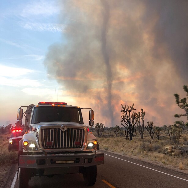
A fire whirl is a rotating column of flame that spins up when intense heat and the right wind pattern come together. Most are small and short-lived. A rare few grow into something with the structure and force of a tornado. On July 26, 2018, during California's Carr Fire near Redding, one such whirl produced winds a survey later estimated above 140 miles per hour, damage equivalent to an EF3 tornado, and a plume that towered to around 18,000 feet. It uprooted trees, flattened steel transmission towers, and killed several people. It is one of only a handful of fire whirls ever documented at that intensity. This is the entry where the honest advice is to keep your distance. These form inside deadly, fast-moving wildfires, and no image is worth your life. Rarity here is not an invitation.
Ball Lightning: The One Nobody Can Promise You
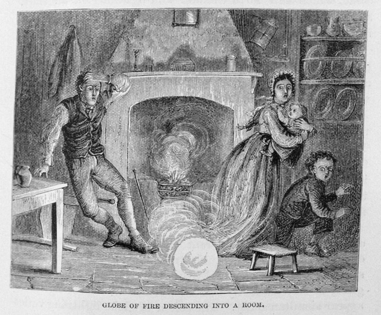
Ball lightning is the strangest and least understood item on this list, a glowing sphere reported to drift through the air, sometimes indoors, for seconds at a time before vanishing or popping. People have described it for centuries, yet it remains poorly documented and hard to study, and a fair number of sightings may be misidentifications or afterimages rather than a single physical thing. The strongest scientific evidence came by pure accident in July 2012, when researchers from Northwest Normal University in Lanzhou, China, were filming ordinary lightning on the Tibetan Plateau and happened to record its spectrum. From about 900 meters away they captured roughly 1.6 seconds of a glowing ball forming after a ground strike, and the light revealed silicon, iron, and calcium, the same elements as the local soil. That supports one leading idea, that a strike vaporizes minerals from the ground into a burning ball. Even so, there is no reliable way to be in the right place to photograph one on purpose. If you ever catch a real one with a camera, you will have documented something a century of scientists mostly had to take on faith.
Lead image — St. Elmo's fire, a branching corona discharge, flickers across the windshield of a U.S. Air Force KC-135 during electrically charged weather. Unlike lightning, it can hold for minutes. U.S. Air Force photo by Staff Sgt. Jackson Manske, Public Domain. Source.






Join the Fstoppers community for free
-
Post comments and join in the discussions
-
Browse the site ad-free
-
Share your work and get featured in the community
-
Compete in the photo contests for fun and prizes
2 Comments
Ball lightning is real. Two family members have witnessed it.
The same shot is used for both a Sprite and St Elmo's Fire