
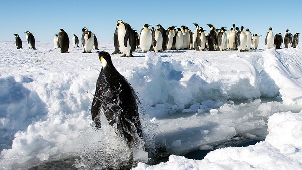
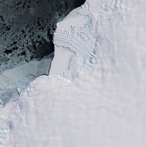
The satellites that first mapped emperor penguins could not see a single one of them. Landsat records the surface at 30 meters per pixel, and a four-foot bird disappears long before that. What those satellites could see was the mess. Emperor penguins spend the winter packed shoulder to shoulder on the sea ice, and they leave behind a reddish-brown smear of guano so large it registers from orbit as a stain on an otherwise blank white continent. Roughly half of the emperor penguin colonies we know about were found not by spotting the birds, but by spotting their poop.
The Stain Is the Subject
Every photographer learns early that you cannot always shoot your subject head on. Sometimes the light is wrong, sometimes the subject is hidden, and sometimes it is simply too small to register on your sensor. So you shoot the evidence instead. You photograph the long shadow instead of the person, the wake instead of the boat, the breath instead of the cold. The scientists mapping emperor penguins made the same move at planetary scale. They stopped hunting for the birds and started hunting for what the birds leave behind.
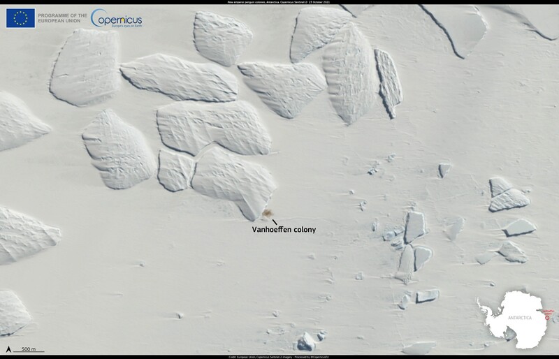
An emperor penguin is the largest of all penguins, standing close to four feet tall and weighing up to 90 pounds. That sounds like a big target until you remember the distances involved. From the satellites used to find new colonies, a single bird falls well below the size of one pixel. It is gone, smaller than the smallest thing the camera can record. The guano is a different story. A colony of thousands of birds sits in one place for months, and the accumulated stain sprawls across tens or even hundreds of meters of flat white ice. Against a continent that is essentially a giant reflector, that brown smear is one of the highest-contrast subjects on Earth.
This is the whole trick, and it is a photographer's trick at heart. Resolution decides whether the subject exists in your frame at all. Contrast decides whether you can pull it away from the background. The penguins lose on resolution and the guano wins on both, so the guano becomes the subject. Once you accept that you are photographing the byproduct rather than the animal, an impossible survey becomes a straightforward one.
What a Camera in Orbit Can Actually Resolve
To understand the survey you have to think about it the way you think about lenses and sensors. The key number for any satellite camera is ground sample distance, which is just the size of the patch of ground that lands on a single pixel. It is spatial resolution described in meters instead of megapixels, and it sets the hard floor on what can appear in the picture.
The imagery that first cracked the problem open was coarse. Landsat records the surface at 30 meters per pixel in its color bands and 15 meters in its sharper panchromatic channel. The European Commission's Copernicus Sentinel-2 satellites do better at 10 meters. At those scales, a four-foot bird does not exist. A hundred-meter guano stain, though, is ten pixels across on Sentinel-2 and easily wide enough to trip a computer looking for anything brown on a white field. Coarse, free, continent-wide imagery is perfect for the first job, which is finding the colonies.
Counting them is the second job, and it needs a much sharper instrument. That work leans on commercial very high resolution satellites, above all Maxar's WorldView-3, which resolves the surface at about 31 centimeters per pixel from an orbit around 380 miles up. At that scale an emperor penguin finally becomes something: a dark clump a few pixels wide, a huddle that reads as a dense black patch against the ice. Researchers do not tally birds one by one. They classify the compact and spread-out shapes of the huddles, then convert that area into a head count using densities measured by people who have actually stood in a colony. It is the same logic as estimating a crowd from a stadium photo rather than counting every face.
Bands matter as much as pixels here. A satellite does not shoot one image the way your camera does; it records several separate channels at once, sampling narrow slices of the spectrum. The panchromatic band is a single high-resolution gray layer that catches the fine detail, while the color and near-infrared bands come in coarser but carry the spectral information that tells brown guano apart from blue shadow and gray rock. Analysts routinely fuse the sharp gray layer with the lower-resolution color to get the best of both, a process called pan-sharpening that has a direct cousin in the luminosity-and-color blends photographers do by hand. The hard part is not seeing the stain. It is making sure a melt pool, a patch of exposed rock, or a long shadow off a pressure ridge does not get mistaken for one, which is why a promising stain gets checked against repeat passes, and often against sharper commercial frames, before anyone calls it a colony.
Put a camera in a photographer's hands and the gap becomes obvious. The longest glass most wildlife shooters will ever mount, something like the Sony FE 200-600mm f/5.6-6.3 G OSS or a fixed super telephoto like the Canon RF 800mm f/11 IS STM, is the ceiling of what a wildlife shooter can carry into the field. Bolt that lens to a 61-megapixel body like the Sony a7R V and you still could not resolve a single penguin from 380 miles overhead, where the bird lands well inside a single pixel of that rig. The satellites succeed at the finding job not because their optics are magic, but because their operators chose a subject that survives the distance.
It Started With a Brown Smudge on Landsat
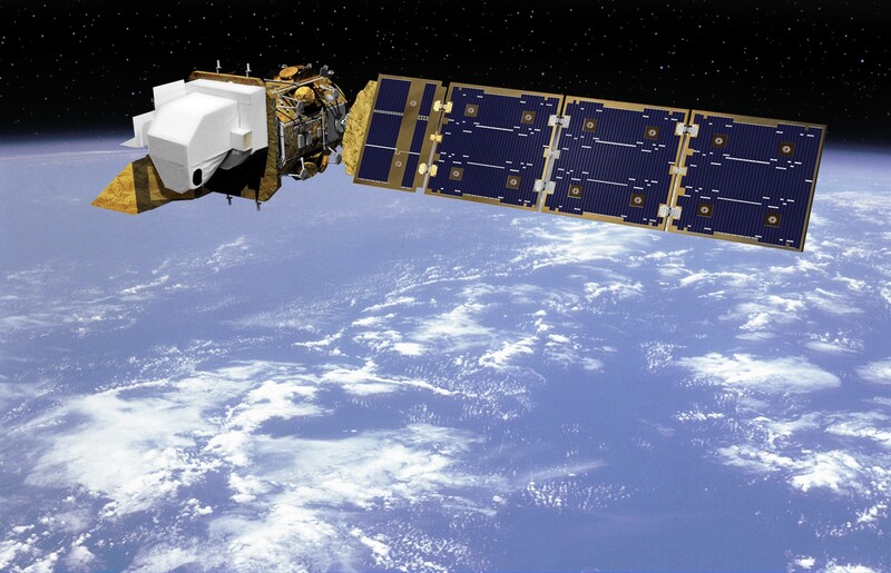
The idea arrived the way a lot of good ideas do, sideways. In 2009, Peter Fretwell and Phil Trathan of the British Antarctic Survey were looking at freely available Landsat imagery of the Antarctic coast and kept noticing brown patches on the sea ice. Those patches lined up with places emperor penguins were known to breed. If the stains marked known colonies, the reasoning went, then unexplained stains might mark colonies nobody had ever recorded.
They tested it against the Landsat Image Mosaic of Antarctica, a stitched map covering about 90 percent of the continent's coastline, and published the results in the journal Global Ecology and Biogeography. The tally came to 38 colonies, ten of them completely new to science. Six previously known colonies turned out to have been mapped in the wrong place, repositioned by more than 10 kilometers once the imagery showed where they actually sat, because the old records carried poor geographic information. Six others could not be found at all. For a species that breeds in the darkest, coldest, most inaccessible places on the planet, this was a revolution in method. No ship, no aircraft, no boots on the ice. Just a person at a computer reading stains on a map that had been sitting in the public domain the whole time.
What makes the story satisfying is how ordinary the raw material was. This was not a bespoke spy platform. It was Landsat, the same long-running civilian program whose archive anyone can download for free, being read by someone who finally asked the right question about a brown smudge. The penguins had been signaling their locations for as long as the satellites had been watching. It took a decade of imagery and a fresh pair of eyes to notice.
Counting a Whole Species From Orbit
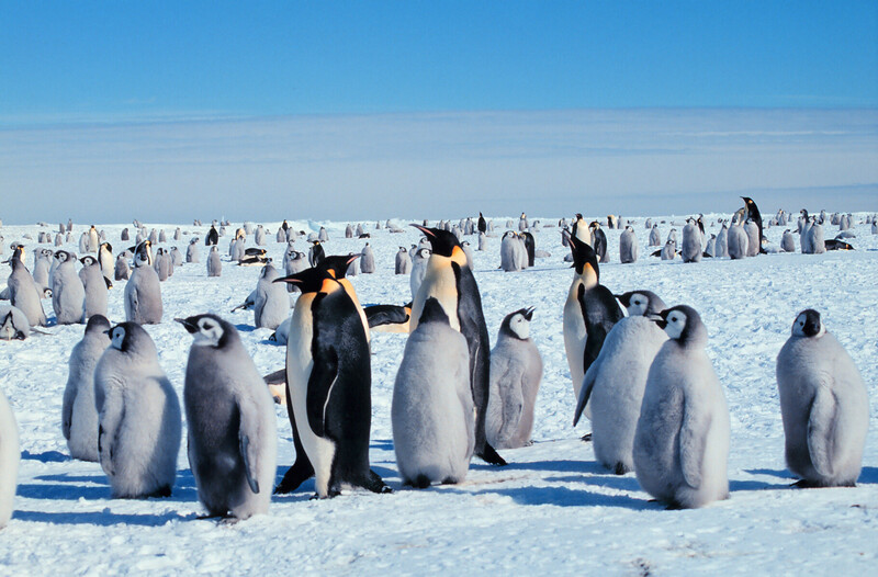
Finding colonies is one thing. Counting an entire species is another, and in 2012 a team led by Fretwell did exactly that. The paper, published in PLoS ONE, billed itself as the first global, synoptic survey of a species from space, and the phrase was earned. The researchers pieced together very high resolution imagery from satellites including QuickBird, WorldView-2, and Ikonos, covered the whole coastline, and ran it through a supervised classification that separated four things from one another: snow, shadow, guano, and penguins.
That classification step is pure image processing, and it will feel familiar to anyone who has ever pulled a mask in Photoshop by luminosity or color. The software learns what a penguin pixel looks like versus a shadow pixel versus a guano pixel, then labels the entire scene. Ground crews had physically counted birds at a handful of colonies, and those counts were used to calibrate how many penguins a given dark area really contained.
The answer reset the textbooks. The survey estimated about 238,000 breeding pairs, which the researchers scaled up to a total of roughly 595,000 adult birds once the non-breeders were folded in. Earlier guesses had put the total somewhere between 270,000 and 350,000. In other words, the view from orbit found nearly twice as many emperor penguins as anyone had believed existed, and it did so without disturbing a single nest. Michelle LaRue, one of the co-authors and a specialist in counting Antarctic animals from satellites, has spent much of her career proving that this kind of remote census is not a gimmick but a rigorous discipline.
None of this is as clean as a single number makes it sound, and the researchers are the first to say so. A satellite pass is a snapshot, and emperor penguins move. On a mild day the colony spreads out and covers more ice; in a storm the birds pack into tight huddles that hide their true numbers under a smaller, denser footprint. The count depends on when the shutter happened to open. That is why the estimates carry real error bars, why the same colony can look bigger or smaller from one image to the next, and why so much of the science is about correcting for the behavior of a subject that will not hold still. It is the exact frustration of any wildlife shooter who knows the frame is only ever one moment out of many.
Why the Guano Is the Perfect Target
Color science is doing quiet work in this whole story, and it is worth slowing down on. Guano is not just conveniently dark. Its exact hue carries information, because the color of a penguin's droppings depends on what the bird has been eating. A diet heavy in krill pushes the stain toward pink and red, while a fish-heavy diet leaves it far paler. Emperors eat a mix of fish, squid, and krill, so their colonies tend to paint the ice in browns and reddish browns.
The reddish tint traces back to a pigment called astaxanthin, the same carotenoid that makes krill, salmon, and flamingos their particular shade. Krill are loaded with it, penguins cannot fully break it down, and it passes straight through to color the guano. When researchers put penguin droppings under a spectrometer, they find a broad absorption feature centered near 550 nanometers, right in the green part of the spectrum, which is precisely what leaves the eye reading pink and red. That measurement was made on Pygoscelis guano, sampled from Adélie, chinstrap and gentoo colonies on Signy Island, and the authors were careful to note that their results do not let them tell penguin species apart by their droppings. The diet-from-orbit work that grew out of it has been done on Adélies rather than emperors, reading guano color in satellite imagery to work out what a colony has been feeding on without touching a bird.
For a photographer this is the concept of a color channel taken to its logical extreme. The ice reflects almost everything, so it is a near-perfect neutral. Drop a saturated brown or red target onto that neutral and the separation in any red-minus-white comparison is enormous. It is the same reason a red jacket pops against snow in your own winter frames. Antarctica just happens to be the largest neutral backdrop on the planet, and the penguins have been decorating it with the one color that stands out most.
When the Ice Gives Way
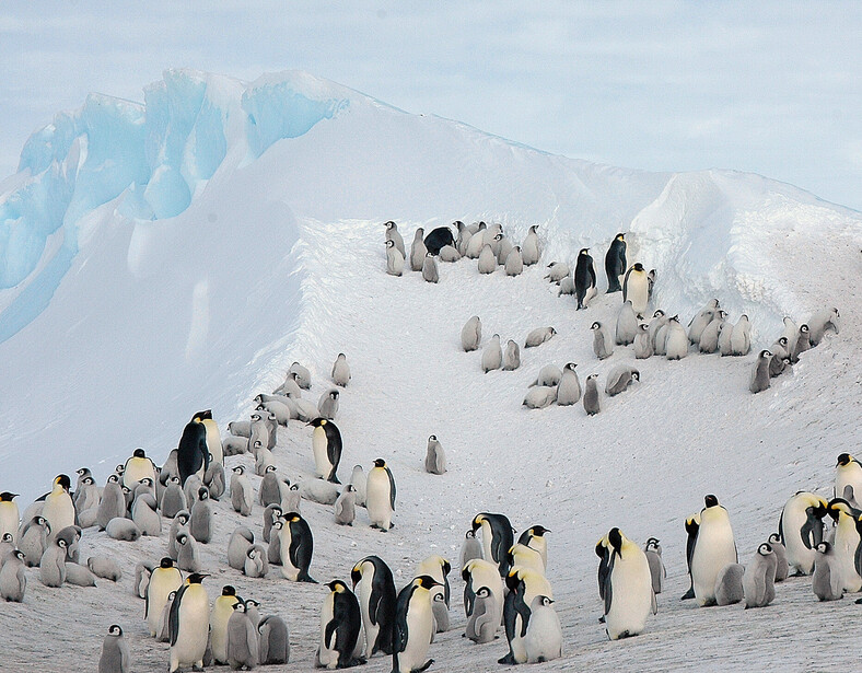
A survey method this good does not only find life. It also documents loss, in unforgiving detail. The clearest example is Halley Bay, in the Weddell Sea, which was until recently the second largest emperor colony on Earth, with somewhere between 14,000 and 25,000 breeding pairs in a good year. In 2019, Fretwell and Trathan reported in the journal Antarctic Science that the colony had suffered three straight years of breeding failure, from 2016 through 2018. Almost no chicks survived.
The cause was written into the imagery. Emperor penguins need stable fast ice that holds from April, when the adults arrive, until December, when the chicks finally grow their waterproof feathers and can survive in the water. At Halley Bay the ice broke up early and repeatedly, and the chicks were lost before they were ready. The satellites caught something else at the same time. About 55 kilometers south, the colony at the Dawson-Lambton Glacier swelled dramatically over the same window, a sign that at least some adults had voted with their feet and moved to more reliable ice. The camera captured what looks like a mass relocation.
Meanwhile the map keeps filling in. In 2020, a sweep of Sentinel-2 imagery turned up 11 more colonies, pushing the global count to 61. A new colony at Verleger Point surfaced in early 2023. In January 2024, the British Antarctic Survey announced four more, found in Sentinel-2 data and confirmed with sharper Maxar WorldView-3 frames, bringing the total to 66 known emperor colonies around the entire continent. As Fretwell put it, these locations "fill in almost all the gaps in the known distribution of these iconic birds." The blank spots on the map are nearly gone, and they were closed almost entirely by reading stains.
The Picture Is Getting Darker
Because the archive now runs back more than fifteen years, the same technique that found the penguins can measure whether they are holding on. In June 2025, a team again led by Fretwell published an analysis in Communications Earth & Environment showing that emperor penguin numbers fell about 22 percent over fifteen years, from 2009 to 2023, across a large sector of Antarctica that runs from Dronning Maud Land west to the Bellingshausen Sea and takes in the entire Antarctic Peninsula. That region holds roughly 30 percent of the world's emperors. The earlier read on the same species, covering 2009 to 2018 across the whole continent, had put the decline at about 9.5 percent. The newer figure is far steeper, though it covers a longer window and a smaller, harder-hit slice of Antarctica.
The framing from the researchers was blunt. The drop, Fretwell said, is "worse than the worst-case projections we have for emperors this century." His co-author Phil Trathan put it as a warning about what is still not understood. "The fact that we're moving to a position faster than the computer models project means there must be other factors we need to understand in addition to loss of breeding habitat," he said. "The only way we'll see a turnaround for the population is if we stabilise greenhouse gas emissions."
That caveat matters, because the obvious reading of these numbers is Halley Bay scaled up, and it is not the one the team offers. Unreliable sea ice remains the central long-term threat, and a bird that cannot breed without solid ice underfoot has nowhere to go. But the population is falling faster than models driven by ice loss alone predict, and the researchers point to shifting storm, snow and rainfall patterns, more competition for food as other species move their ranges south, and heavier predation from petrels, seals and killer whales working newly open water.
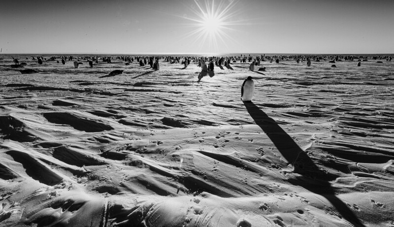
There is a strange dignity in how this loss is being recorded. No one is following these animals with a long lens through a blizzard. The penguins are documenting themselves, month after month, in a medium so simple it is almost a joke. Their own waste marks where the colony stands, in a color that happens to be the one thing a satellite can always see, and a sharper frame counts who is still standing there. Every year the archive gets one more layer, one more frame in a time-lapse nobody wanted to shoot. The most important wildlife photograph of the emperor penguin may turn out to be a picture in which you cannot see a single penguin at all.
Lead image by Christopher Michel, CC BY 2.0. Source.






.jpg)


.jpg)
Join the Fstoppers community for free
-
Post comments and join in the discussions
-
Browse the site ad-free
-
Share your work and get featured in the community
-
Compete in the photo contests for fun and prizes
2 Comments
Shorter headline: Penguins Tracked by Their Skid Marks.
Is this how the USS Enterprise detects life signs from orbit?